Placer Mining and the Ah Yee Mining Company
Ah Yee Mining Company
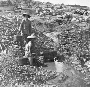
Chinese migrants and Chinese Americans were a big part in John Day’s earliest years. As early as 1870, there was a Chinese community of over 940 people, approximately 850 were gold miners. Several Chinatowns were established in towns such as John Day, Canyon City, and Susanville which housed a majority of the community, there were also camps near gold mining claims that housed the Chinese gold miners during mining season.
There were several Chinese owned and operated mining companies who worked within the Malheur Forest boundaries in the late 1800s. Though it was not legal for Chinese Americans to own land, Chinese companies in Grant County still purchased mining claims, usually on a lease, from Euro-Americans who thought their claims had been “played out”. One such company was the Ah Yee Mining Company. This was one of the earlier Chinese mining claims, which was purchased from Stephen Graham to Ah Yee and Company for $300.00 in 1869. This included multiple mining claims, a cabin, one ditch, and a multitude of tools.
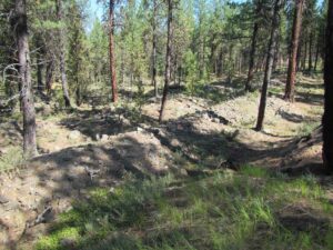
This mine extends throughout the Vincent Creek drainage with extensive ditches and features which were built after the 1869 purchase. This area has undergone mining well into the 1940s but many of the placering areas can still be seen!
Placer Mining Process
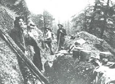
When one thinks of mining, they often imagine miners working inside hills or mountains, using pick axes and carts to wheel out gold or other materials from a rock or ore. And that is a type of mining, but not placer mining; think of placer mining as panning for gold! Placer mining uses water to excavate, transport, and recover heavy minerals from alluvial deposits. These deposits consist of minerals that have eroded from their parent lode into a variety of natural contexts among the sedimentary formations.
Ditches
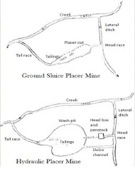
Placer mining consists of complex elements and features that make this such an interesting, and sometimes difficult, area of research. There are many waterways that go into placer mining. The water originates from a source, usually a creek or river. A ditch is constructed called a lateral, which diverts water from that main source. These laterals can connect to many different mines, therefore head races are dug, which is another type of ditch that leads the water to the place where the physical mining is happening. As the water filters through the mine, it’s taken out by way of a tail race, which connects to the original water source. A sluice channel can also be built which has an option to let in more water needed to sifting for gold or can be closed off.
Features
There are many features related to mining that archaeologists look for when recording mining sites. Locating and following the ditches is an important step to find the following features. Prospect pits are some of the first activities miners did in their search for gold. These small pits were dug in order to determine if the area had gold worth digging!
Placer cuts and wash pits are areas where the earth was dug up using free flowing or pressurized water, literally cutting into the ground! Dams and reservoirs were built and used to retain ample amounts of water to allow mining in drier months. Larger ones were built for hydraulic mining which build sufficient water pressure.
Tailings are one of the final features found in mining sites. These are often waste rock and gravel that was haphazardly stacked as miner removed them from the mining area, often directly behind the miner as they worked.
Artifacts
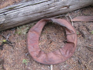
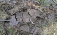
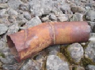
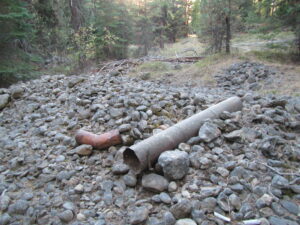
In additions to the ditches and features recorded, there are often artifacts specifically associated with the tools and devices used by the miners. Artifacts recorded in these sites include: five-piece gold pans that were used in the first stages of gold mining. Shovels and shovel pieces are often used in gold mining to dig up the earth with the aid of water. Work boots, especially the soles, have been found in these mines. Also nozzles and penstocks which were part of hydraulic mining and used to build and control the pressurized water. We also find scrap metal and so much more!
Archaeology and You!
Do your part to preserve our history! If you come across artifacts while hiking or recreating, please do not touch! You are more than welcome to take a fun photo or report the finding to the Heritage department, but please leave the object be. These objects tell an important story about the lives of individuals and a big part of telling that story is recording these objects in their found location. Archaeology is a cool science and we appreciate you all attending the 2021 virtual Archaeology Roadshow!
The Malheur National Forest
As seen on the Malheur website!
The 1.7 million acre Malheur National Forest is located in the Blue Mountains of Eastern Oregon. The diverse and beautiful scenery of the forest includes high desert grasslands, sage and juniper, pine, fir and other tree species, and the hidden gems of alpine lakes and meadows. Elevations vary from about 4000 feet (1200 meters) to the 9038 foot (2754 meters) top of Strawberry Mountain. The Strawberry Mountain Range extends east to west through the center of the forest. Plan your camping trips with our interactive recreation maps today by visiting our recreation page for all you need to know and more.
Visit our associated websites here:
Malheur National Forest,
Supervisor’s Office
431 Patterson Bridge Road
John Day, OR 97845
541-575-3000
