By Gregory (Grisha) Post, Heejun Chang and David Banis,
What is a disappeared stream?
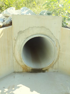
A disappeared stream is a stream that has been buried, moved, or removed to make way for urban development. Removing a stream has many negative impacts on biodiversity, and may increase pluvial (rainfall) flooding risks. Mapping where streams have disappeared represents the history of how urbanization has impacted natural water courses
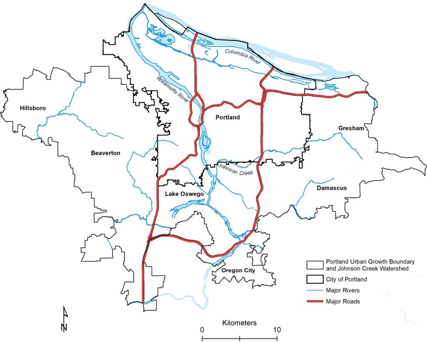
Buried streams were mapped in a study area which includes the Portland, Oregon Urban Growth Boundary and Johnson Creek Watershed.
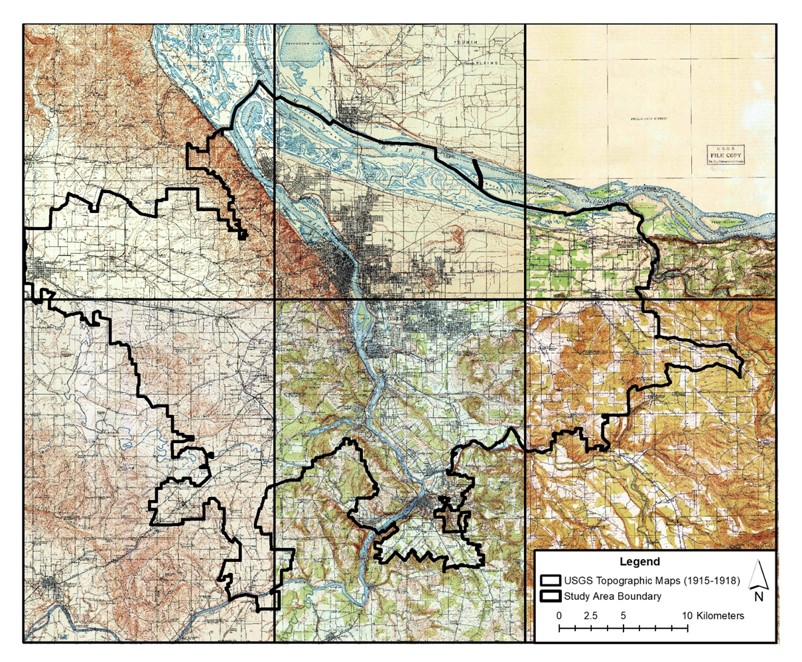
Historical topographic maps from the USGS were used to identify where streams disappeared. If a stream was shown on the map and not on a modern high resolution aerial photography, the stream location was traced using GIS software. Multiple historic maps from 1852 to 1990s were used to cover the study area.
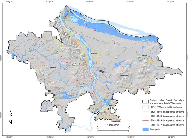
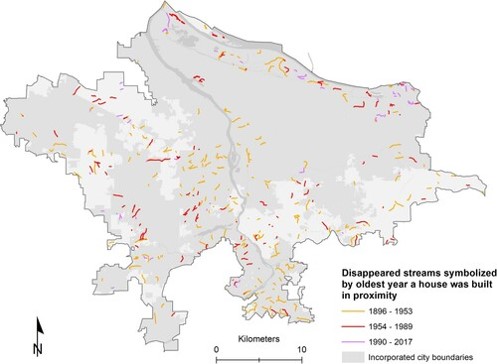
A map was created showing disappeared streams symbolized by the time range in which they disappeared. Some development occurred before the oldest topographic map we used so some of the oldest disappeared streams were likely not mapped.
This map shows the same disappeared streams symbolized by the construction year of the oldest house near each former stream. Looking at the oldest house construction year may indicate when an area was first developed and a stream was removed.
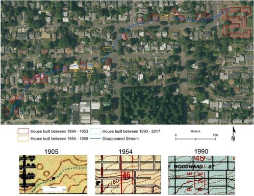
This is an example of a disappeared stream and the houses that are in the area the stream used to inhabit. The lower maps show the stream labelled in 1905 and it no longer exists in 1954 and 1990. Most of the houses in this area were built before 1954.
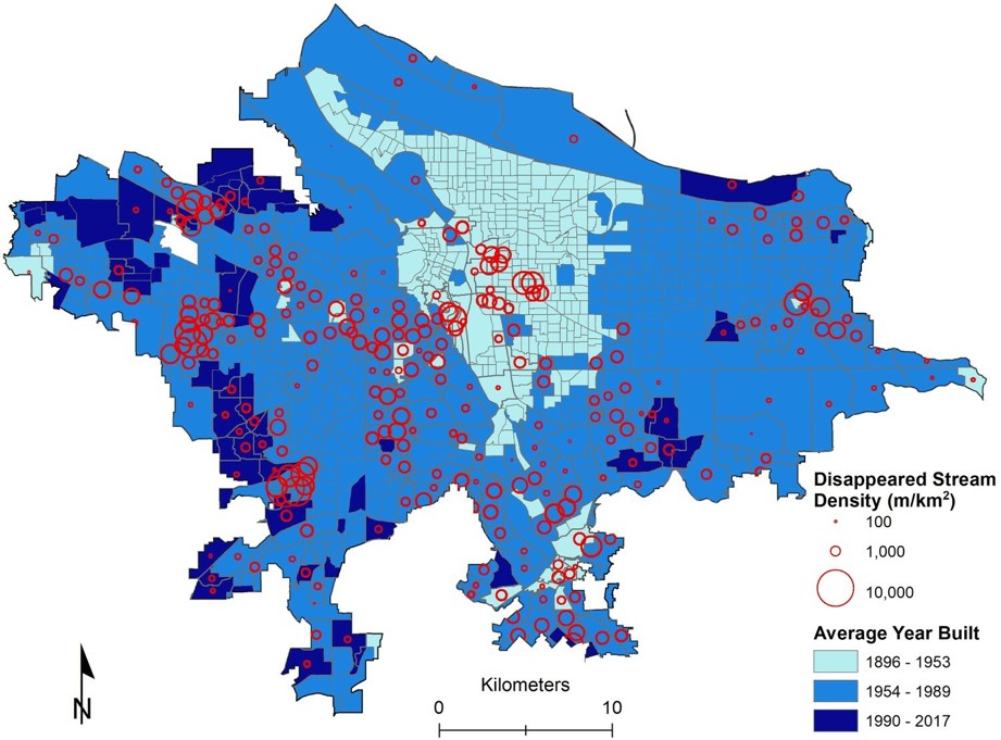
This map shows the density of disappeared streams per census block group. The largest density of disappeared streams occurred between 1954-1989. In areas that were more recently developed (1990 – 2017) there is a lower density of disappeared streams.
Conclusions
Disappeared streams represent the history of urbanization that has often buried, culverted, or removed streams throughout our cities. There are now many initiatives to open or “daylight” as well as restore culverted streams in many urban areas. Restoring the ecological function of streams can increase urban biodiversity and may help reduce flooding risk as we see more extreme weather events linked to climate change.
The full article can be found in the Journal of Maps:
https://www.tandfonline.com/doi/full/10.1080/17445647.2022.2035264
